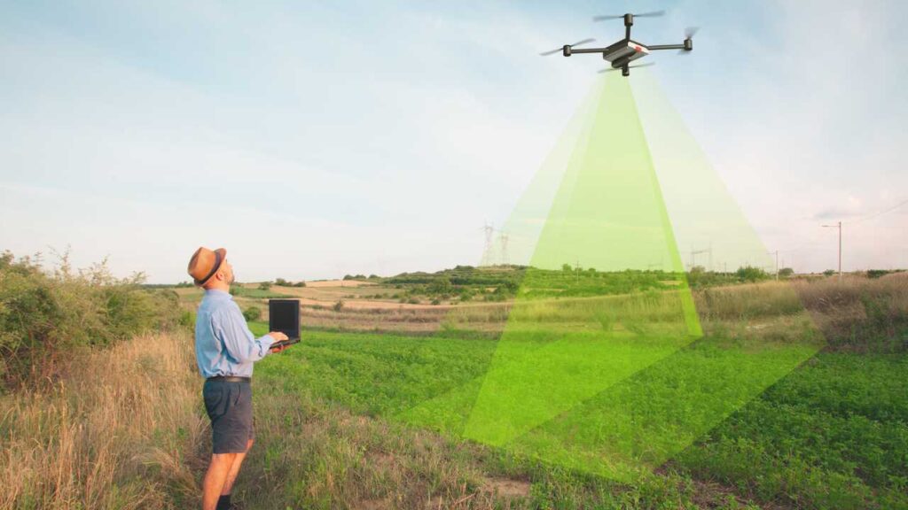
Whether you’re a drone pilot considering adding mapping to your skillset, or a team leader looking for the best drone mapping software, you’ve landed in the right place!
Industrial drones have become powerful. They map large areas and collect data quickly and cheaply. This guide gives you a better understanding of how drones are used in mapping and land surveying. It will also introduce you to the best drone mapping software on the market.
Table of Contents
#1 Drone Mapping Software Applications
Construction
By using maps in the construction industry, clients can receive regular updates on the progress of their projects. They can analyse raw materials, including dirt and gravel. They can even create 3-dimensional models. Construction managers can use these maps to get an overall picture for informed decisions.
Land Survey
Land surveyors can use drones to take precise measurements. They can create legal documents, maps, and land plots. By using photogrammetry, surveyors can obtain an accurate map that can be converted into a 3D topographic map with contours. In the past, this process was labour intensive.
Yet, if you are not a licensed surveyor, you should not claim that you can provide “survey-grade” results. Find out what the state requirements are before you advertise.
Real Estate
An aerial map can be of considerable value to those considering buying a property. Standard satellite imagery usually lacks detail. Drone mapping solves the problem of clarity.
Potential buyers save the hassle of visiting the property in person. Property details can be determined by viewing an aerial map. It is possible to overlay contour lines and precise boundaries over the imagery.
Exploration and Mining
Drone mapping has already made inroads in the mining industry. Detailed maps are essential for managing waste rock piles, analyzing water drainage, detecting erosion, managing pits and waste rock piles. Constant updates give managers a better sense of the situation.
Inspection
Pilots use cameras to visually inspect assets. Using drones on a small scale can make it easier to create detailed maps of roofs. They accurately detect leaks and poor insulation too.
For example, the energy industry can use infrared mapping to inspect solar farms and identify problem areas in solar panels.
Agriculture
Agriculture is the most common application of UAS. Maps allow farmers to quickly analyze their crops. Through proper training and the use of NDVI imagery, a farmer can determine the safety and health of his or her field in real-time.
A drone can produce a semi-automated map of the crop and flag trouble spots. Farmers don’t have to deploy a tractor or walking the entire field. Agribusiness can thus save time and improve crop yield.
Forestry
To detect and track illegal logging, count trees, and monitor forest health with detailed maps. Besides forest fire prevention, NDVI images can help identify areas of dry vegetation. Also, maps can reveal whether the forest has been afflicted by a disease, such as identifying dead trees.
Emergency
Emergency management relies on quick and accurate information. Drones come in handy especially when a disaster involves a large area.
Officers can use drone photogrammetry to determine the most damaged areas during disasters. Such as floods or hurricanes.
Case Studies
If you want to read more real-life applications, here is a range of case studies put together by a leading surveying drone manufacturer.

#2 Glossary of Mapping
- Photogrammetry
Photographs taken from the air. Usually used to make measurements.
- Orthomosaic
Correction of an aerial image to ensure that it is uniformly scaled across the entire image, taking into account topographic relief, camera tilt, and distortions in the camera lens.
- RGB Camera
Mapping traditionally uses a camera of this type. An image is created by taking samples of the Red, Green, and Blue light spectrums.
- NDVI
A derived image is calculated using a modified RGB or near-IR sensor (also known as the Normalized Difference Vegetation Index). Plants are ranked based on the amount of reflection they provide, so NDVI gives them a -1 to +1 value. NDVI correlates with a healthy plant when it reflects more light and has more chlorophyll. Unhealthy plants have a low concentration of chlorophyll. An analysis of crop health can be done with the help of NDVI, which is a valuable tool for those in agriculture.
- GCP
Ground Control Points are a means of keeping a map’s geographical accuracy by placing physical markers on the ground. Locations of GCPs are described by an FTK (Full Time Kinematic) GPS coordinate (or other GNSS systems). Your whole map will be aligned with the geographical area around it because of this very accurate coordinate. A piece of the image is aligned with a GPS coordinate on the earth, meaning it ensures one point of the image is aligned with that spot. A survey-accurate map is essential if it will be compared with older map data, overlaid with remote imagery, or relied upon to produce results for survey management.
- Near-Infrared
The light has a wavelength slightly below that of visible light (electromagnetic radiation). Plant health can be determined by how much NIR light is reflected off of it. For this type of data, special cameras such as NIR, broadband, or multispectral ones will be needed.
- Infrared
An IR wavelength or light is more lengthy (lower frequency) than a near-infrared wavelength. IR can detect heat, which is one of its benefits.
- Thermography
Using infrared light, thermography takes images. Often used in industrial applications, this imagery depicts areas of heat in an object. A new way to earn money for drone pilots is thermographic work, which is growing in demand.
- RTK
Real-Time Kinematic satellite navigation is a technique that uses GPS (or any other GNSS) data to obtain centimetre-accurate results. This data is calculated by analyzing the GPS radio signal via the RTK receiver. RTK is a big deal – GCPs can be omitted from drones that come with RTK receivers on board.
- Point Cloud
Objects’ surfaces are described as point clouds, which are collections of points or coordinates. A 3D model of an area can be created from this collection of points. Photogrammetric and LIDAR data are commonly used to generate point clouds.
- Relative Accuracy
Referring to maps, relative accuracy describes the distance between two points on a map. It follows that two points on a map that are X cm apart should be X cm apart in reality.
- Absolute Accuracy
Exactly where a point is in relation to its coordinates in the real world is what is known as absolute accuracy. The exact coordinates of a map point must match those of its GPS. This is known as “Absolute Accuracy”.
- Resolution
The detail on a map is measured by its resolution. CM/Pixel measures the density in CM per pixel, which means that each pixel represents a certain quantity of CM.

#3 Best Drone Mapping Software
DroneDeploy
Founded in 2013, DroneDeploy is a leading provider of drone photogrammetry software.
It supports DJI drones through cloud-based processing. It allows the collection of NDVI data, to make orthomosaics, create digital terrain models, and generate 3D models. It targets the agriculture, construction and surveying industries.
DroneDeploy is known for its simplicity yet rich functionality. Field Scanner, their unique feature, enables farmers to access real-time NDVI maps. Those maps are generated during flights without any internet connection. Third-party plug-ins are available on DroneDeploy’s App Market.
The app comes with a free version, as well as higher options for professionals, businesses, and enterprises.
Propeller
Propeller allows data collection, process and visualisation.
For construction companies, mining companies, quarries, and landfills, Propeller tackles accurate survey data. It answers critical questions about their site’s progress, productivity, work quality, and safety. Their clients include some of the world’s leading construction and mining players.
Pix4D
Pix4D is a Swiss company that offers software for photogrammetry.
It is a robust software that offers a wide range of features. It includes products that focus on mappers (Pix4DMapper), engineers (Pix4Dbim), farmers (Pix4Dag), and 3D models (Pix4Dmodel).
PIX4DCapture is an app to automate the mapping process. It is compatible with DJI and Parrot drones. Pix4D users can process data on their own hardware or by cloud.
Pix4D offers a free trial. The cost of a perpetual license is about a few thousand dollars. In spite of this, Pix4D continues to rank among the top mapping software. Its feature-rich versions focus on specific industries. This makes it an effective tool for surveyors, civil engineers, agricultural producers and many more.
Raptor Maps
Raptor Maps was founded by MIT engineers in 2007. Precision agriculture and inspections are the core functions. Creating thermal maps is one of their unique features.
Solar panels, electrical utilities, and roof inspections are some of its applications. The company also provides agriculture monitoring software and hardware. Farmers can generate reports on a field’s health using their Harvest Monitor sensor. It allows them to make better agricultural decisions.
Precision Hawk
Based in North Carolina, Precision Hawk has made a name for itself in the UAV industry, especially in agriculture.
Their mapping solution includes tools for crop health analysis and volumetric measurements, as well as orthomosaics and 3D models.
It offers many tools that can help analyze your imagery, much like an app store. In addition to standard NDVI enhancements, there are canopy cover calculators and roof report generators, as well as algorithms to locate standing water in fields. Farmers and insurance companies could find its Precision Mapper useful.
Skycatch
Skycatch was founded in 2013 in San Francisco. They work with major construction companies, including Komatsu and Bechtel, to provide enterprise-level solutions. A variety of deliverables can be made using Skycatch, including orthomosaics, contour maps, surface models, etc. Additionally, their software integrates with CAD programs.
Skycatch supports DJI drones, as is their own drone with built-in RTK, the Skycatch Drone. Skycatch makes remote imagery integration easier for construction companies.
Drofika
Users can automatically transform aerial images into 2D and 3D models using Drofika’s smart aerial data platform. Since its platform is cloud-based, users can access these models from any device.
Aerial images can be uploaded to Drofika to get daily updates, providing information that is more accurate than traditional surveying methods, as well as cost-effective solutions to save time and reduce rework.
WebODM
The WebODM mapping software is free and open-source. Because the API is open source, experts can download it and add functionality to it.
You can make orthomosaics and elevation models with this software. AutoCAD and QGIS are also supported. Mappers who want to map for fun or who are a bit more computer savvy than average users may be interested in WebODM.
Agisoft
In 2006, Agisoft was founded in Russia as a technology company. Its products are capable of photogrammetry, 3D modelling, panorama stitching, and fish-eye lens support.
You can make point clouds and digital elevation models, take measurements, process RGB, NIR, thermal, and multiband images, all using the professional version of this software.
If you need comprehensive photogrammetry and 3D modelling package, Agisoft is for you.
Maps Made Easy
Maps Made Easy allows users to pay as they go. Besides photogrammetry, MME can also calculate stockpiles and generate NDVI maps. You can even georeference your maps.
Map Pilot from Maps Made Easy allows you to control your DJI drone while flying the mapping mission. Light users who don’t need mapping on a regular basis, or don’t require powerful computing hardware will find it approachable. Users don’t need to be tied to a monthly subscription.
#4 What to Do Next?
Now it’s time to train yourself or your staff to get the most out of the software and run a lucrative drone mapping business. Check out our complete guide to the best online drone schools and courses!
